MONITORING FARM DAMS WITH TECHNOLOGY
Farm dams are the beating heart of a farm. They are biodiversity hotspots, drive farm productivity, and influence carbon cycles by emitting or trapping greenhouse gases. These processes are complex.
We work with engineering partners at Leading Edge Engineering Solutions to constantly develop new technology to improve our ability to monitor dams and understand how to improve them.
Pondi sensors for greenhouse gases
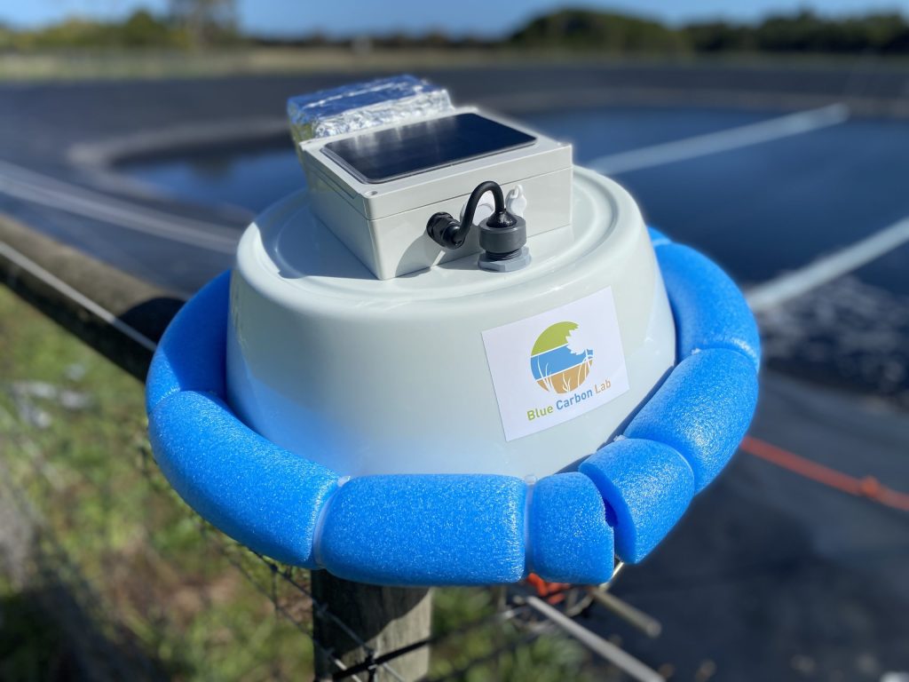
We developed the “Pondi”, a simple sensor to monitor greenhouse gases from aquatic systems. Our technology can deliver data in real-time on carbon dioxide (CO₂), methane (CH₄), and nitrous oxide (N₂O).
Pondi sensors are designed to float atop water bodies (e.g., farm dams, wastewater lagoons, wetlands) and send data to our server in the Cloud. Depending on weather conditions, Pondi sensors can last for around a month before requiring cleaning and recalibration.
We aim to distribute Pondi throughout Australia to understand how we can manage them better. Our data will inform how to improve water quality, reduce emissions, and increase local biodiversity. Read more about Pondi sensors.
We’ve kicked off a hands-on citizen-science program with Pondi for farmers to keep an eye on the health of their farm dam. Learn more about our Farm Dam Citizen Science program.

Automatic biodiversity monitoring
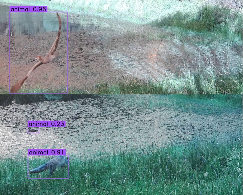
We are developing automatic cameras, field microphones, eDNA, and AI technology to monitor the wildlife associated with farm dams in Australia. Our science shows that farm dams host several species threatened with extinction (Malerba et al. 2023, article on The Conversation).
Our vision is to develop a simple, low-cost technology for farmers to monitor how their aquatic habitats benefit local wildlife.

Remote sensing and interactive platforms
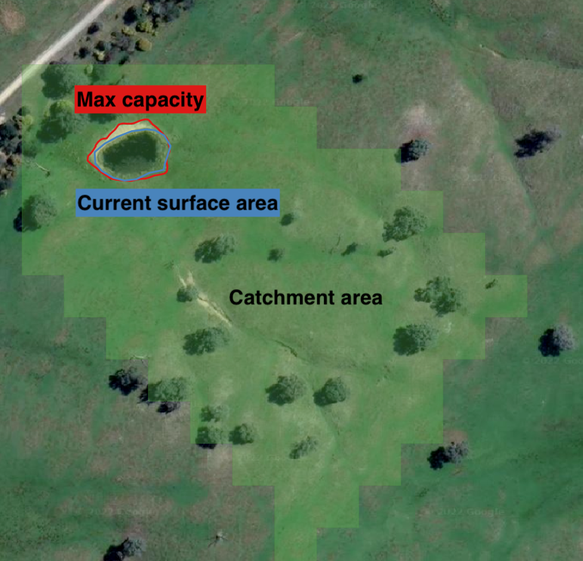
Farm dams are hard to monitor: too many, too small, and located in remote private proprieties. Improving current satellite methods is a necessary step to understanding the role of farm dams in the environment, with important economic and social benefits. The Blue Carbon Lab collaborates with State (WA Dept. Primary Industries and Regional Development) and Federal (Dept. of Environment and Energy) agencies to develop new tools to monitor small waterbodies. We use high-definition satellite images and AI to analyse water surface, maximum surface area, surrounding catchment area, and vegetation type and cover (Malerba et al. 2021, Malerba et al. 2022).
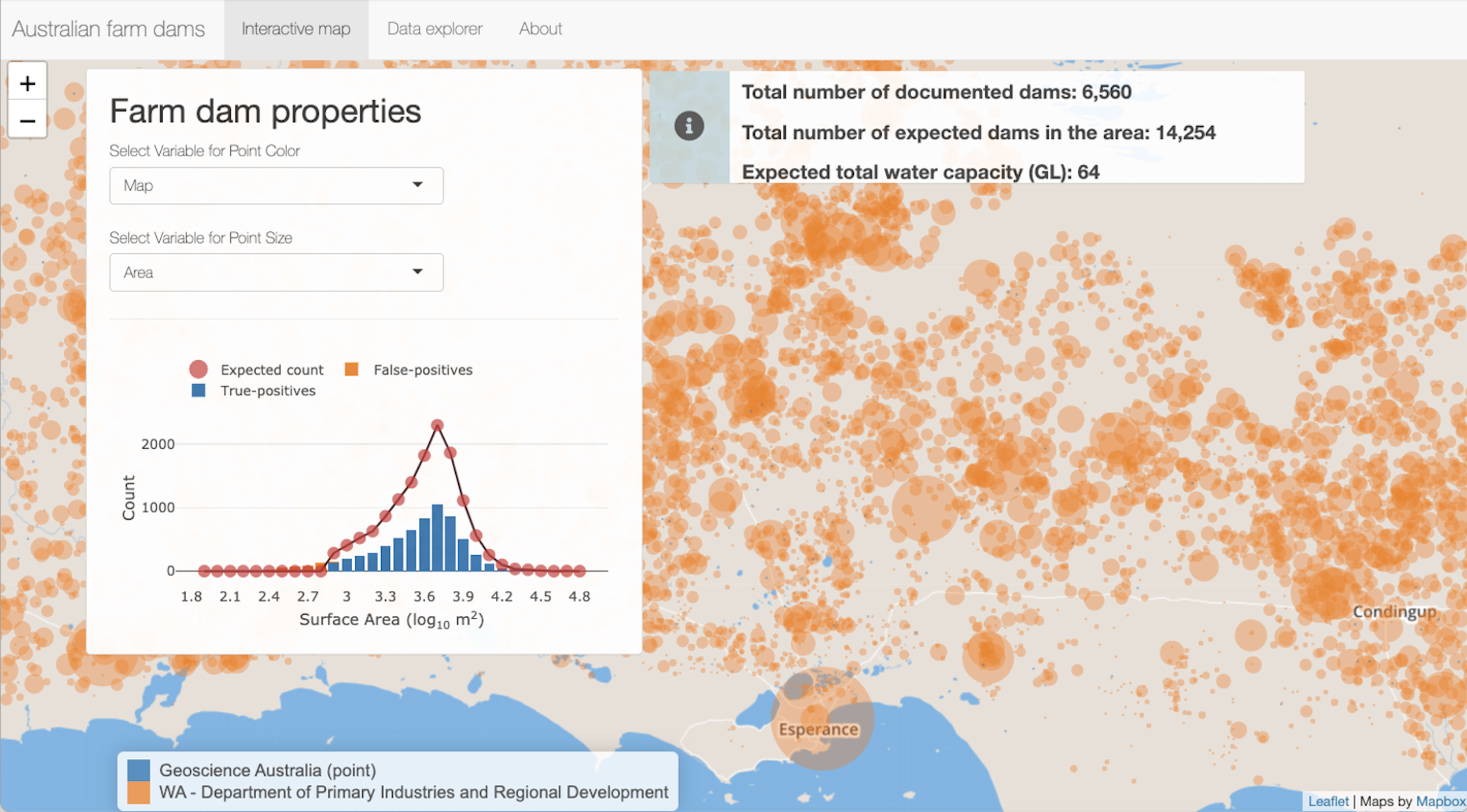
We created AusDams.org – a free interactive website to share our farm dam database with the Government, farmers, scientists and the general community.
The portal is simple: the user needs to navigate on a map to any area of Australia to generate tailored statistics, plots and tables on various aspects of farm dams (e.g., count, density, total surface area, size distribution, water capacity).
Our portal can support research or help choose the location for new dams. We are committed to expanding AusDam.org as data becomes available to support all these applications.


