

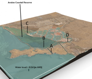
Development of a Restoration Action Plan is underway! Researchers from UNSW Water Research Lab are creating a hydrodynamic model to test restoration scenarios at Avalon Coastal Reserve.
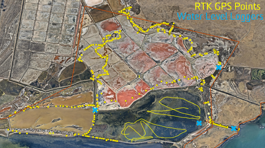
In August 2019, A/Prof. Will Glamore and Dr. Valentin Heimhuber from the UNSW Water Research Laboratory conducted topographic (RTK GPS) and bathymetric (Echosounder) surveys around the Avalon Coastal Reserve and installed four water level loggers. This campaign also included a survey of all hydrologically-relevant features such as the tide gates and important channel cross sections.
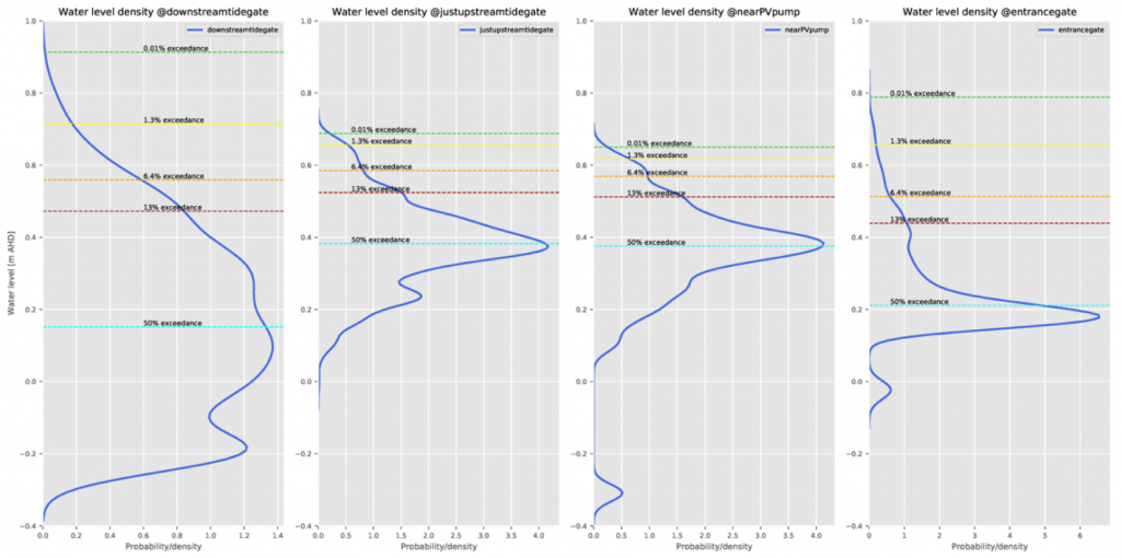
The data from the water level loggers, still active in place, has been used to establish and understand the existing hydrology of the site (i.e. hydroperiod, depth of inundation, flushing and connectivity). The water level histograms illustrate that the tidal inundation regime within a relatively small area in and around the reserve varies dramatically, which is the result of structures and the constricted connection of the site with the bay.
The data from the water level loggers, still active in place, has been used to establish and understand the existing hydrology of the site (i.e. hydroperiod, depth of inundation, flushing and connectivity). The water level histograms illustrate that the tidal inundation regime within a relatively small area in and around the reserve varies dramatically, which is the result of structures and the constricted connection of the site with the bay.
Several digital elevation models (DEMs) exist for the Avalon Coastal Reserve. The most suitable DEM has been selected and acquired through DELWP. Comparison with the RTK GPS data collected across the site showed that the DEM is reasonably accurate for most ‘dry’ areas, but, as expected, has poor representation of all ‘wet’ areas such as the channels, the main lake or the inundated salt ponds. Using a range of GIS techniques, the GPS and Echosounder data was used to correct the DEM in all problematic areas, as shown below.

After ensuring that the DEM represents the current site condition well, the team at WRL applied GIS-based inundation modeling (see animation), to get an initial feel for how the site hydrology could look like after restoring tidal flows. This form of modeling, however, does not account for the aforementioned tidal attenuation resulting from the constricted nature of the entrance channels that currently connect the Avalon Coastal Reserve to Port Phillip Bay.
A set of representative restoration scenarios were discussed during a 1-day workshop between the UNSW and Deakin teams. The WRL is currently developing a hydrodynamic model of the site from all available datasets. In a first step, this model will be calibrated using the data from the water level loggers. Once calibrated, the model will be used to simulate the hydrological outcomes of the agreed restoration scenario, which range from a minimal intervention, to a fully engineered solution.
For each of these hydrological outcomes, secondary outcomes such as distribution and abundance of intertidal vegetation communities, fisheries productivity and water bird habitat suitability will be quantified (jointly between UNSW and Deakin), to ensure that the key site and stakeholder requirements are met.